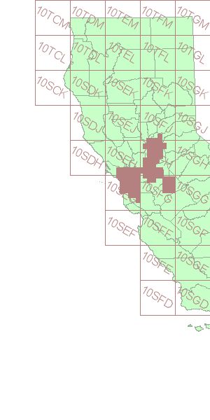
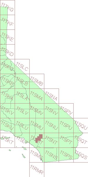
This directory contains 0.3 Meter Urban Area Imagery for the State of California. The data is organized in the United States National Grid (USNG) format using the first five numerical digits and letters in the identifier for the image.
The following two image maps depict the collection of urban imagery currently available in CaSIL, for UTM projections 10 and 11. Click on the USNG grid cell in the image map below to go to the directory containing imagery with the given prefix.
| UTM 10 | UTM 11 |
|---|---|
| |
|